OK. So, that title was just to see if you were paying attention. It was actually the Lyndon B Johnson National Historical & State Parks, but the only LBJ that gets my fan vote is Lady Bird Johnson. ‘Not a fan of Lyndon. The park was interesting though. I visited there with friends but, after this, headed to Amistad National Recreation Area by myself for a short stay.
As we moved to our third camping spot on the coast, we made a stop at the Patton Center/Marine Science Institute at the suggestion of one of our number, Diane. It was free and worth a visit. Plenty of parking.
We moved on to a free camping area on Indianola Beach next. Amenities: Pavilions with picnic tables, bathroom, and an outdoor shower (for swimmers). Enjoyed watching the sea/coastal birds including a number of brown pelicans & listening to the waves constantly coming in. Occasional ships and fishing boats could be seen in the distance. We also found a local hole-in-the-wall restaurant with great seafood. All of our time on the Texas coast was a bit hot and sticky but helped by coastal winds.
TEXAS. APRIL.
A Couple Creatures from the Aquarium at the Patton Center/Marine Science Institute
After our first day at the three-day Sandfest, we went back to Padre Island to go to the Visitor Center and walk on the beach. Then we returned to the Sandfest the next day to see the progress of the sculptures and find out who won the various categories of the contest.
After the Sandfest, we moved to the Mustang Island State Park campground. Hookups and bathrooms with showers were a nice change from Bird Island Basin.
Before I started traveling fulltime, I had heard about “Texas Sandfest”, the largest sand sculpture competition in the U.S.
Even though I was all the way up in Utah, when I heard some friends were attending, I made some marathon drives to reach the Texas coast in time for the event. It was everything I thought it would be. The sculptors were just amazing, and it was interesting to see the techniques and tools they used.
At our first campground, my campmates and I were also treated to watching wingfoilers and windsurfers each day. This Bird Island Basin area on Padre Island NS is a mecca for those learning these amazing sports. Below the gallery is a video of these athletes.
Of course, just spending time on the beach was enjoyable and quite a change of pace for me. The setting and sea/bird life and the local seafood was great!
(see captions for more info) (also, a reminder to click the first image for a slideshow & captions)
TEXAS. APRIL.
Wingfoiling and Windsurfing at Bird Island Basin, Texas
After my stay in Tucson, I headed back to the Yuma area and then up to Quartzsite to volunteer for a charity I support, Homes on Wheels Alliance. After that, another stay in Southern California to rest up from the busy volunteer days. Friends invited me to stay at their Nevada home for a while and then it was off to Apple Valley, Utah, to camp with a friend’s group.
My photos from these stays ended up being mostly of weather and celestial events–at least until I got to Utah. It was a pretty part of the state that I had not visited before. After that, I decided to head to Texas for an event I’d been wanting to attend for some years.
I started heading even further south toward some friends’ house in Tucson with a camping stop in Southern California near Yuma. While getting vehicle repairs in Tucson, I visited a couple NPS sites, Fort Bowie National Historic Site and Chiricahua National Monument.
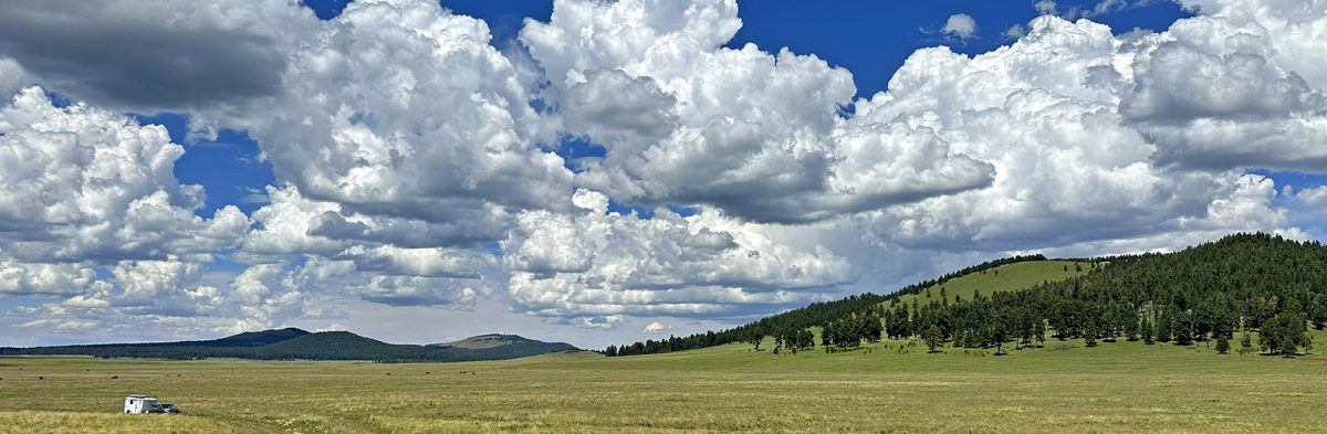
This is my third or fourth stay in the White Mountains. I always love coming because the light here is extraordinary.
A strange thing happened as I neared the area. I was driving along a remote two-lane when I came upon a vehicle upside down on the shoulder. A guy had stopped, and I slowed to ask if anyone was inside. He said he hadn’t found anyone. There wasn’t a signal at that location, so he said someone had driven one way to get a signal to call 911. I said I would drive in the opposite direction to try the same. After driving some distance, I was able to call emergency services. I went back to the accident site where by now more people had gathered; I let them know I had been able to get a call through. They still had found no victims. Since it was getting late, I decided to leave and, several miles down the road, met the responders on their way to the scene. I checked the local news for the next few days but never did see anything about the accident. Both a bizarre and sobering event.
I drove all the way to the area in which I planned to camp, arriving after dark – something I almost never do. I simply pulled off the dirt road for the night and the next day, scouted out a camping site for myself and friends I was meeting.
This is a beautiful area that I highly recommend.
(see photo captions for more info)
Stormy skies on the approach to the White Mountains
Agriculture, wildlife, sunsets, domestic animals, a transported wind turbine rotor blade in a precarious situation – I never know what I’m going to see around the next curve or over the next hill – but I know it will be interesting and new.
As I headed south through North Dakota, I found a nice little camping area provided by the Lions Club in Bowman, ND, with bathrooms & a dump station. They asked for a $12 donation. It was an easy stop for the night. I had heard of civic groups providing spots for travelers, but this was a first for me.
Next, I headed into South Dakota and camped at Hugh Glass Lake. At the time, the camping was free, but I just read they are now charging $16.91/night (a strange amount!). I did not know until I spoke with a couple camping next to me that Hugh Glass is the man about which “The Revenant” was made. I haven’t seen this film, but I understand his is a remarkable story of survival.
The nearby town of Lemmon SD, made for an interesting visit with its petrified wood park, and artistic murals and sculptures.
I was excited to visit the Theodore Roosevelt Park as I’m a bit of a Teddy fan. Not politically but personally — and because of his conservation efforts and support of National Parks. Even if folks are not in his fan club, I would think most people would find him interesting, at least. He led a varied and fascinating life. From NPS site: “President – Colonel – Rough Rider – Father – Naturalist – Rancher – Theodore Roosevelt was all of these things and more. His life was one of constant challenge and adventure. “
The Park has both a south and north unit. The visitor’s center at the south unit had a lot of good historical information and exhibits.
I was also interested in the Park because, before I came out on the road, I had heard of the abundance of wild horses found here. I saw some but had hoped for more. On my next visit, I plan to do more research on when and where to find them. There was a good bit of other wildlife which I always enjoy.
Despite the lack of horse sightings, this Park was a highlight for me.